Meteo stations
By entering the main Map menu and selecting the Meteo stations submenu, a list of all Meteo stations is displayed. Weather stations in Serbia are shown here and data from your weather stations could be displayed in the same way.
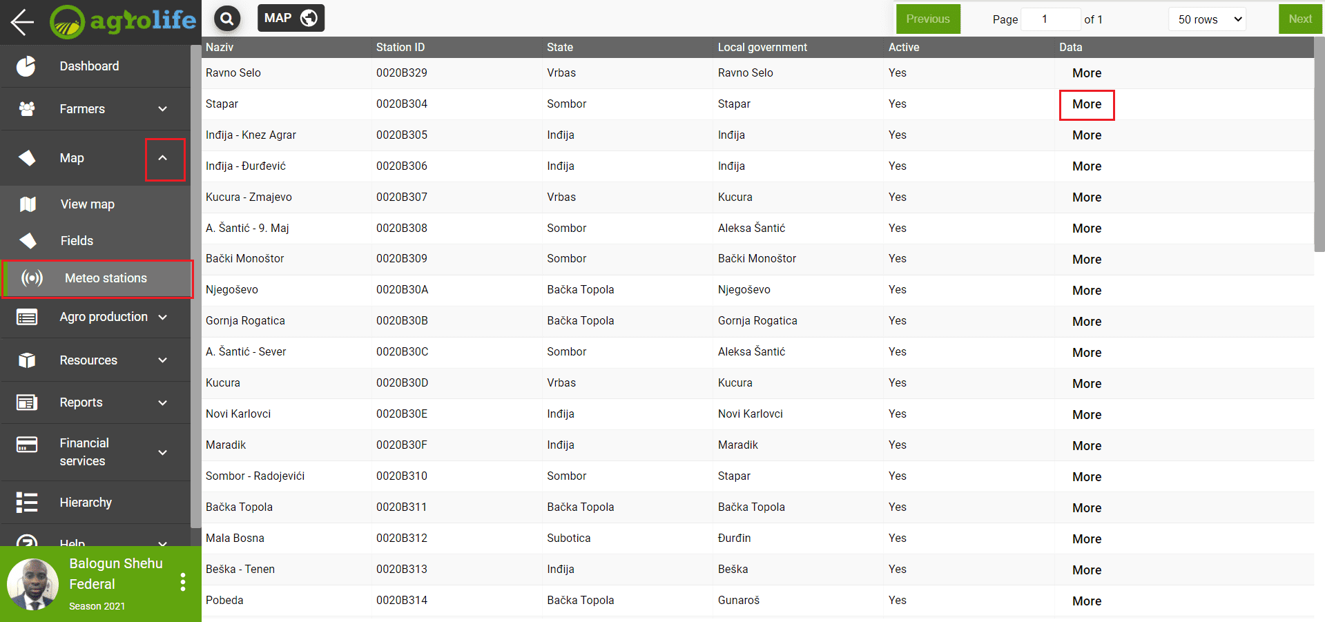 Figure 1: List of meteo stations
At the top of the window, there are the following tools:
- Search - Click on the magnifying glass icon - the station is searched.
- Navigation toolbar - in the upper right corner - go to the appropriate page to display data if there is more than one page of data.
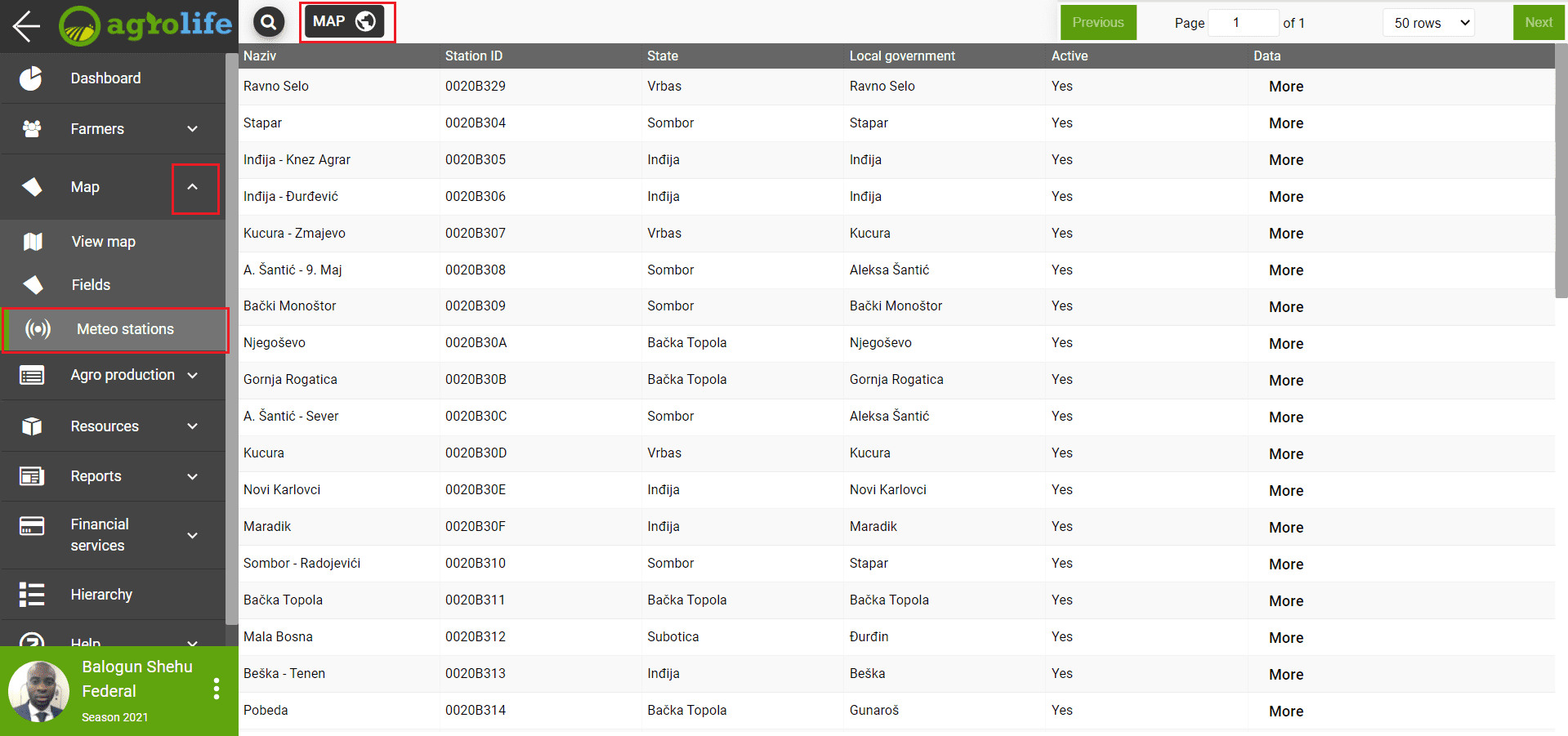 Figure 2: Toolbar and go to map
Clicking on the MAP button (Figure 2) at the top of the window opens a map showing the weather stations.
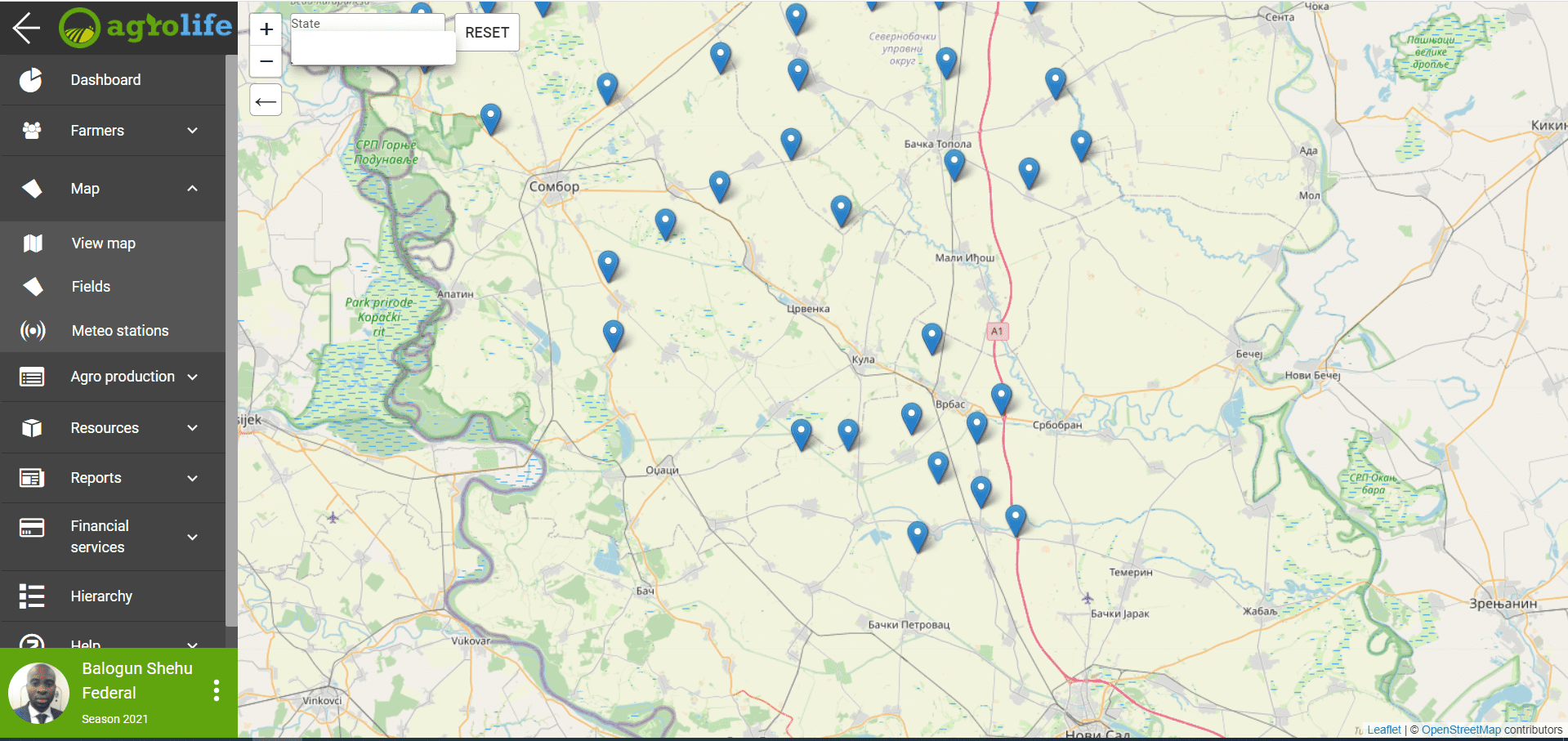 Figure 3: Display of meteo stations on maps
On this Map, you can see the meteo stations in Serbia and the data on the locations where they are located.
 Figure 4: Choice of meteo station
Clicking on a weather station will open a window with the name of that station and the current temperature. Click on the More field to get more information from that weather station.
Data
When you click on the Data field, a window opens as in Figure 5. On the left side of the menu, the following fields are offered: Data, Temperature, Precipitation, Humidity, Wind, Pressure. Clicking on each of these fields opens new data that is displayed on the graph when the field is clicked. This data is historical. Data is given for the current time, yesterday, the previous 7 days and the previous 30 days depending on what you choose. Clicking on one of these four options gives you a graphical representation of the data. Within the Data field, you have the opportunity to get General data, related to temperature, humidity, precipitation and much more in the past period. The right side of the graph is the present moment, as you go to the left, the data is shown backwards.
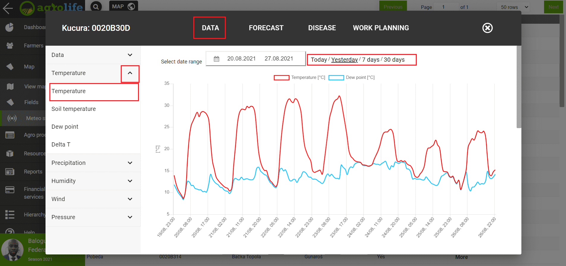 Figure 5: Data
Clicking on each field offered will provide a graphical representation of the data up to 30 days back.
Forecast
By clicking on the Forecast field (Figure 6), you will get a forecast for the next 3 or 7 days, depending on what you want to be shown on the chart. On the left side you have the forecast for: temperature, precipitation, humidity, evapotranspiration, wind, pressure and more. The forecast is displayed by the hour.
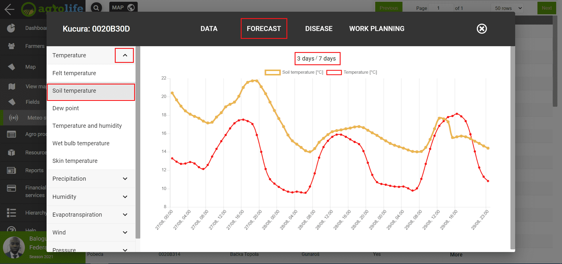 Figure 6: Forecast
Disease
By clicking on the Diseases option (Figure 7), the weather station offers the possibility to see data on whether there was a risk of diseases and pests going back up to 30 days. On the left side of the screen is a list of cultures. Clicking on the selected crop will bring up a drop-down list of diseases for that crop. Clicking on one of the diseases will open a graphical representation of the risk for that disease. Several graphs open in the window, so below the first one that shows the risk, you get a graph with the parameters wich affect the onset of disease.
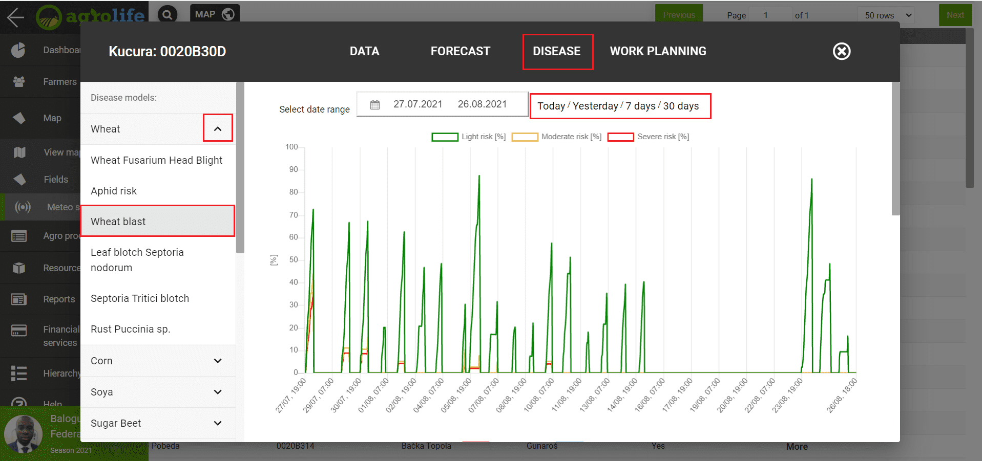 Figure 7: Disease
Work planing
Work planning refers to recommendations for specific activities in the field. Based on the forecast, the station generates data and gives a recommendation whether it is possible or not to perform certain activities. By clicking on the Planning option on the left side, you get the opportunity to view the forecasts for the next period of seven days, for: sowing, plant protection, harvesting and other (Figure 8).
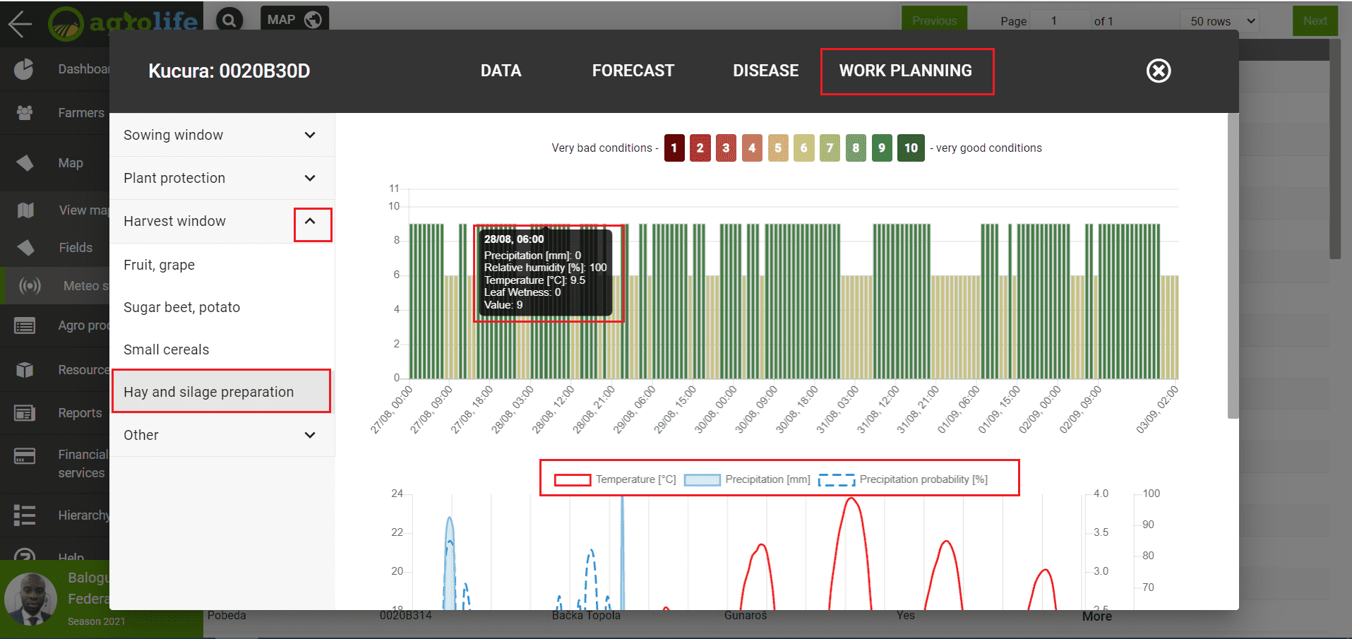 Figure 8: Work planing